Production of a hydrologically correct 10 m Digital Elevation Model (HCDEM) covering all of New Caledonia, and development of an ArcGIS add-in for exploring modelled watersheds and the hydrographic network.
Context
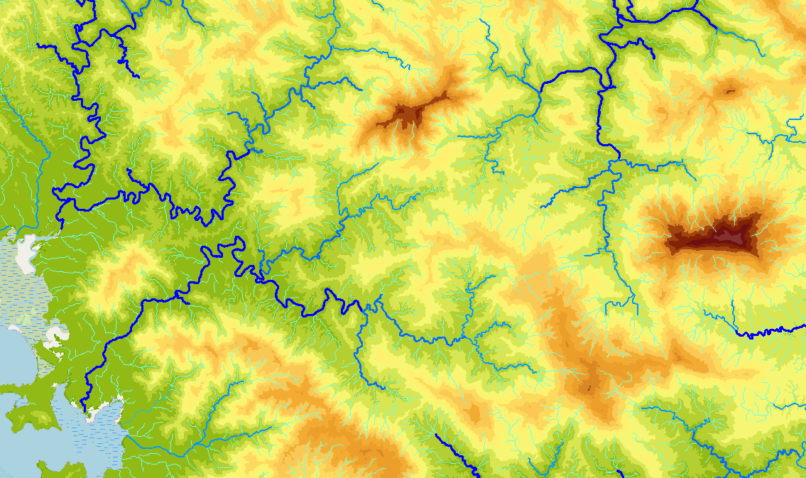
The DAVAR Water Department required a hydrologically correct Digital Elevation Model covering Grande Terre in order to compute watersheds, drainage networks and flow accumulations. Generic DEMs contained sinks and topological inconsistencies that distorted hydrological modelling in low-gradient areas. MAGIS delivered the project in two phases: HCDEM production in 2014, followed by a consultation tool in 2016.
Solution
HCDEM generation — The DEM was built using Topo to Raster interpolation from BDTOPO-NC data (contour lines, spot heights, watercourses, cliffs, depressions, coastline). The method is iterative: across 152 areas of interest defined by DAVAR, watercourses are manually corrected (flattening, upstream-to-downstream orientation), the DEM is generated, sinks filled, and watersheds computed — repeating until the result is consistent with the BD TOPO. The entire workflow is scripted and automated across all 152 zones. The final DEM is assembled from 34 tiles of 50 km with distance-weighted blending at tile borders, delivering full coverage at 10 m resolution in RGNC 91-93 Lambert NC projection.
Hydrological tool — An ArcGIS add-in (ArcMap 10.x) written in Python lets Water Department staff explore HCDEM-derived products directly in their mapping interface. By selecting one or two reaches of the modelled hydrographic network, the tool instantly computes and displays the watershed, longest flow path, and reach statistics: Strahler and Shreve stream orders, flow accumulation, elevations, slopes, mean annual rainfall, and peridotite surface coverage.
Outcomes
Full coverage of Grande Terre — hydrologically consistent 10 m DEM, 152 zones processed iteratively, delivered with derived products (drainage network, watersheds) in a file geodatabase.
The tool makes the data directly usable by hydrologists without manual geoprocessing, and the output layers (watershed, hydraulic path) can be exported for use in further studies.