Land & Environment

Institutions, environment, Open Data: geospatial portals that unlock territorial assets and support governance.

See case studies

Services

GIS for institutions and territories

Institutional mapping portals

Design and deployment of ArcGIS Enterprise portals for governments and provinces. Security, system integration, automation, web apps and maps.

Environment & natural resources

Biodiversity monitoring, hydrology, forest and agricultural management. Multi-criteria analysis and spatial modelling.

Open Data & transparency

ArcGIS Hub platforms, open data publication, metadata and open APIs.

Crisis management & civil security

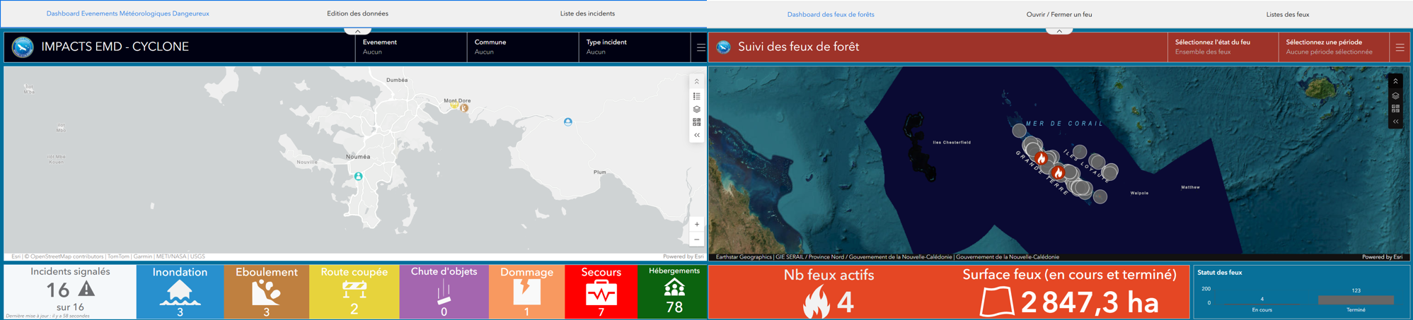
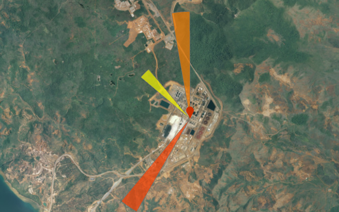
GIS for natural hazard management (cyclones, flooding), emergency coordination and field monitoring.

Case studies

Territory projects

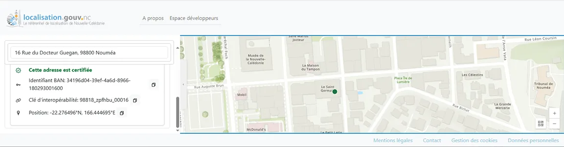
Location API — Sovereign geocoding for NC

2025

DINUM — Government of New Caledonia

Deployment of a sovereign geocoding API for New Caledonia: open API, public website and ESRI-compatible locator, integrating cadastre, addresses and POIs. Docker-based architecture, Agile delivery on government digital infrastructure.

Duration: 7 months

View project

Brick my Map !

2025

CNES

MAGIS-led brick map assembly workshop at the Motion Juice Festival, using ArcGIS Pro to rasterise a CNES satellite image of Kanuméra Bay into an assembly plan, documented via StoryMaps.

Duration: 1 month

View project

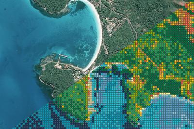
Environmental Observatory — Marine Mammal Observations

2025

Direction de l'Environnement — French Polynesia

Angular and Java web platform with a JavaScript mobile app for recording geolocated marine mammal observations in French Polynesia, integrated with ArcGIS and compliant with RGPD requirements.

Duration: 7 months

View project

Monitoring of cyclones and wildfires.

2024

DSCGR

Real-time monitoring suite for cyclones and wildfires, combining a QuickCapture mobile app for field data collection with ArcGIS Dashboard for decision-support supervision.

Duration: 2 months

View project

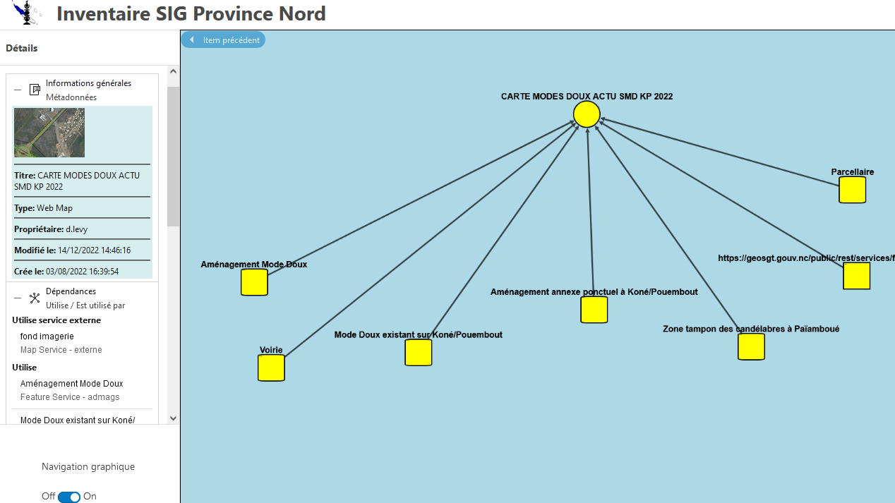
ArcGIS Portal inventory & supervision

2024

Province Nord — Information Enhancement Service

JavaScript and Python solution for inventorying and visualising dependencies among 16,964 items in the ArcGIS Enterprise portal, with a scheduled-task supervision dashboard.

Duration: 3 months + 1 month

View project

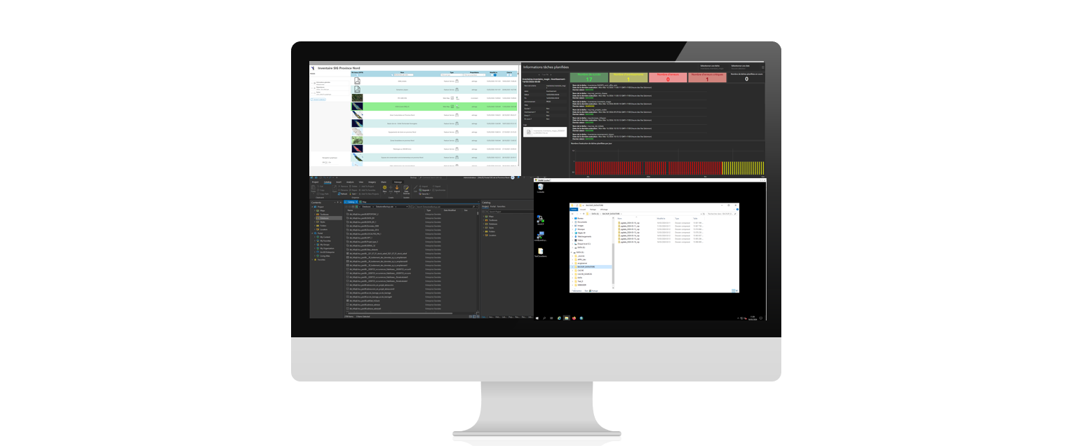
ArcGIS Portal Supervision, Automation and Administration

2024

Province Nord - New-Caledonia

Python and JavaScript (Svelte) solution for inventorying the provincial ArcGIS portal, supervising scheduled tasks, and managing daily PostgreSQL GIS database backup and restore operations.

Duration: 3 months + 1 month + 1month

View project

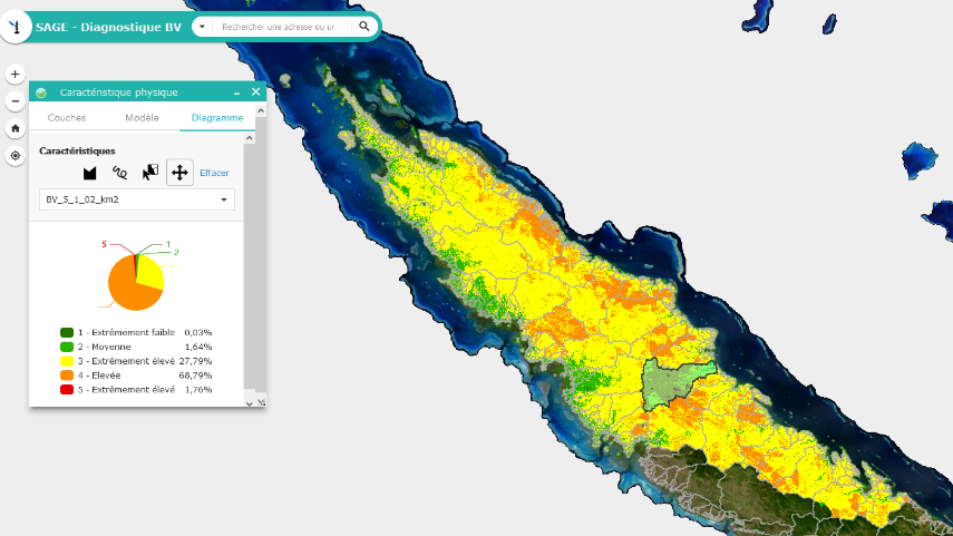
Watershed Assessment

2023

North Province — Water Management and Planning Department

Multi-criteria analysis tool built with ArcGIS Suitability Modeler and Model Builder to diagnose watershed health and prioritise interventions along the hydrological network of New Caledonia's North Province.

Duration: 12 months

View project

Wind Rose

2023

Prony Resources

Agile development of a Python-powered real-time meteorology wind rose, visualising hourly wind direction and speed to alert Prony Resources agents to chemical exposure risks.

Duration: 3 months

View project

TOHORĀ TURE — Whale Watching Supervision

2023

Direction de l'Environnement — French Polynesia

React Native mobility application for real-time supervision of whale watching operators in French Polynesia, ensuring RGPD-compliant monitoring and enforcement of cetacean protection regulations.

Duration: 9 months

View project

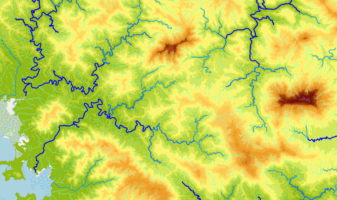
Hydrologically Correct DEM & Hydrological Tool — DAVAR

2016

DAVAR — Water Department

Production of a hydrologically correct 10 m Digital Elevation Model (HCDEM) covering all of New Caledonia, and development of an ArcGIS add-in for exploring modelled watersheds and the hydrographic network.

Duration: 2 years (2014–2016)

View project