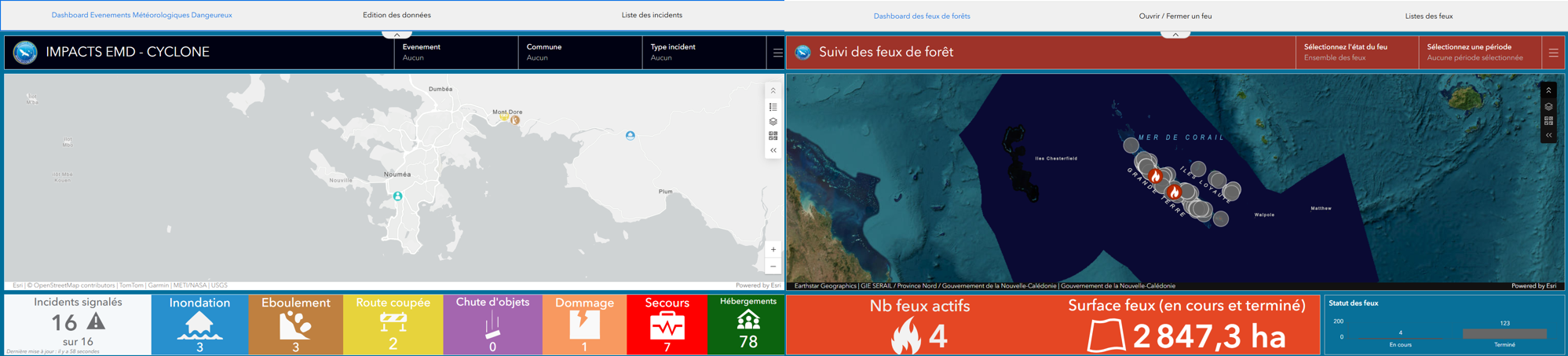
Real-time monitoring suite for cyclones and wildfires, combining a QuickCapture mobile app for field data collection with ArcGIS Dashboard for decision-support supervision.
The DSCGR has expressed a strong need to be able to track hazardous weather events and fires and manage them in real time.
Solution : An initial solution for field personnel was the development of a mobile app using QuickCapture. This app makes it easy to collect information about the incident in progress, including the location of the incident, photographs, and the incident perimeter. The second solution for supervision was dashboards. Using ArcGIS Dashboard, we were able to pull data from QuickCapture, allowing firefighters to see in real time where an incident is occurring and what type of incident it is, so they can best plan their response.