
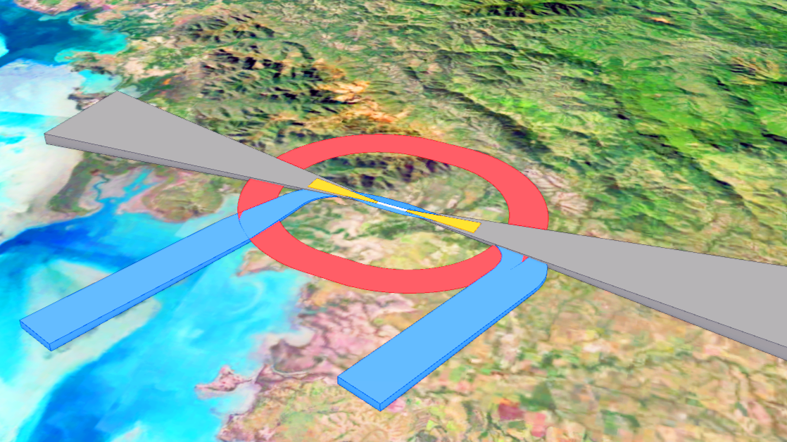
ArcGIS Pro Add-In in C# and Python using 3D Analyst to automatically generate ICAO-compliant surfaces and volumes, thereby contributing to aviation safety.
Context
The DAC-NC needed to automate the generation and updating of its aeronautical easement plans. The SERVAU project (Automated Easements / SERVitudes AUtomatisées) developed by MAGIS replaced an obsolete internal tool. Following the successful delivery of the initial solution, the project was renewed over multiple years to incorporate new features and enhancements.
Solution Implemented
Algorithms – MAGIS developed algorithms to generate regulatory landing and takeoff surfaces and volumes in 3D, exportable to various GIS formats (geodatabase, shapefile, KML).
UI / UX – Technical specifications entry for each French airfield (mainland France and overseas territories) was streamlined via a bilingual user interface seamlessly integrated into ArcGIS Pro.
Obstacles – Building upon the surfaces generated by the algorithms, MAGIS developed intersection tools to evaluate obstacles of various geometries (point, linear, polygon). The results enable the safeguarding of airport zones based on penetrating obstacles.
Layouts & Maps – The SERVAU tool includes standardized layouts, enabling DAC-NC officers to automate the production of regulatory PDF maps.
Multi-runway Support – Through iterative enhancements, SERVAU was expanded to manage multi-runway airfields, which involve distinct operational and design requirements.
Regulatory Compliance – To address evolving aviation standards at both French and international levels, SERVAU was progressively updated to comply with the latest regulatory decrees.